


Hurricanes are powerful and destructive forces. These natural phenomena start as small disturbances and can grow into huge storms as they gain strength and size over the ocean. When one makes landfall in a populated area, it can cause tremendous destruction. You may have seen images of the devastation caused by hurricanes like Otis, Katrina, and Ian in the news or on social media.
Here are some key hurricane facts to help you understand hurricanes better, learn how to prepare, and provide support for those affected.
Hurricanes: Facts, FAQs, and how to help
-
- How does a hurricane form?
- What are the five characteristics of a hurricane?
- When is hurricane season?
- Why are hurricanes dangerous?
- How do I prepare for a hurricane?
- What’s the difference between a tropical depression, tropical storm, hurricane, and a major hurricane?
- What are hurricane categories, and what do they mean?
- How do tropical storms and hurricanes get their names?
- What have been some of the worst hurricanes to strike the U.S.?
- How does World Vision respond to hurricanes?
- How can I help people affected by hurricanes and other natural disasters?
How does a hurricane form?
A hurricane is an extremely strong storm that gains power from warm tropical waters. According to the National Oceanic and Atmospheric Administration (NOAA), hurricanes often start as low-pressure areas called tropical waves, which move through moist tropical regions.
As these weather systems move across the tropics, warm air from the ocean rises into the storm, creating an area of low-pressure underneath. More air rushes in, which then rises, cools, and forms clouds and thunderstorms. The water in the clouds condenses, releasing heat that fuels the storm even more.
When the storm’s wind speeds reach 74 mph (119 km/h), it is officially classified as a hurricane. The term “hurricane” is interchangeable with “tropical cyclone” and “typhoon” — they all refer to the same type of weather phenomenon but are called different names depending on their location in the world.
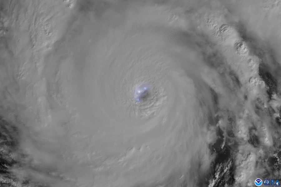
What are the five characteristics of a hurricane?
Hurricanes are complex weather systems, and their characteristics can vary depending on the storm’s intensity, size, and other factors. However, their main features can be summarized as follows:
- Outflow is the high-level clouds moving outward from the hurricane.
- Feeder bands are the areas of heavy rain and gusty winds fed by the warm ocean. They get more pronounced as the storm intensifies.
- The eyewall is the band of clouds and intense wind and rain surrounding the eye of the hurricane. Here, the air moves violently toward the eye and upward into the cloud.
- The eye is the relatively calm and clear area at the center of the storm.
- The storm surge is the flood of ocean water pushed inland as the hurricane approaches land.
When is hurricane season?
While hurricane season varies depending on the region, globally, September is the most active month for hurricanes. A breakdown by region:
- The Atlantic hurricane season is from June 1 to November 30 but sharply peaks from late August through September. This time of year accounts for more than 97% of tropical activity.
- The Northeast Pacific basin experiences a broader peak with hurricane activity often beginning in late May and running until early November. There is a peak in storminess in late August and early September.
- The Northwest Pacific basin has tropical cyclones (referred to as typhoons) occurring throughout the year, although the main season is from July to November, with peaks in late August and early September.
- The North Indian basin has activity peaks in May and November, although tropical cyclones are seen from April to December.
- The Southwest Indian and Australian/Southeast Indian basins have similar cycles, with tropical cyclones beginning in late October and early November, reaching peak activity in mid-January and mid-February to early March, and then ending in May.
- The Australian/Southwest Pacific basin begins with tropical cyclone activity in late October and early November. It peaks in late February to early March and then fades out in early May.
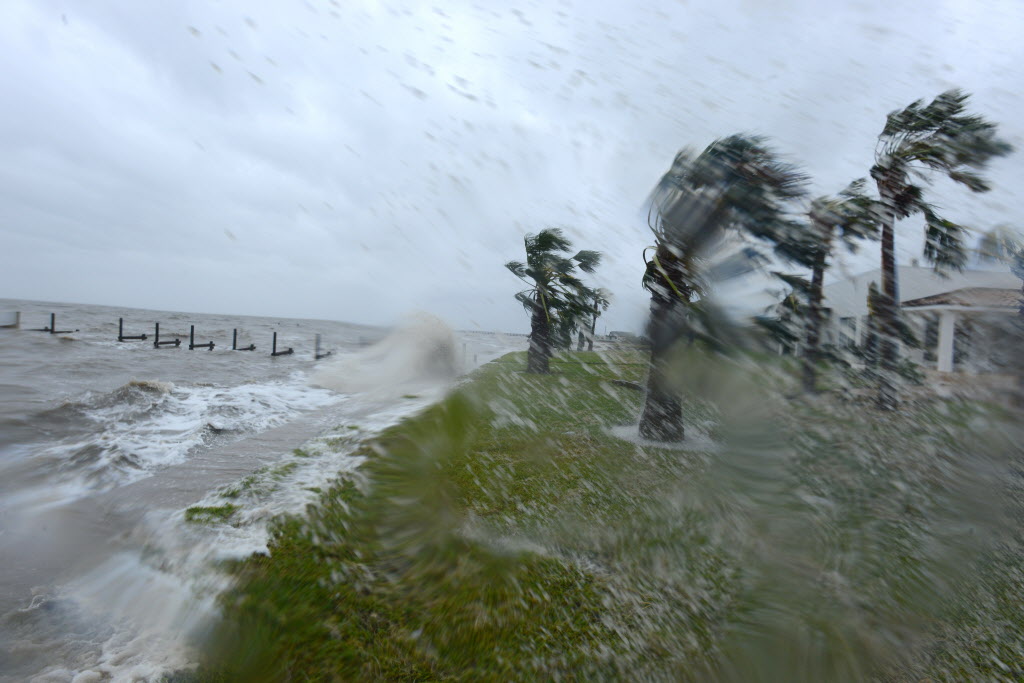
Why are hurricanes dangerous?
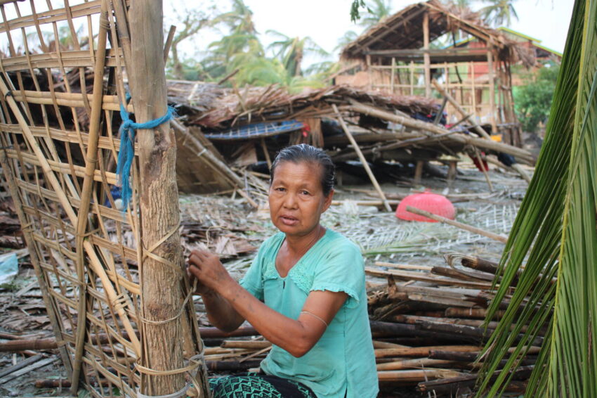
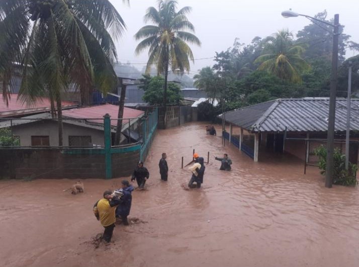
Hurricanes pose significant dangers due to several factors. The powerful winds can damage or destroy buildings, homes, trees, and other property, knocking out power. People can be lifted off their feet by high winds or injured by flying debris.
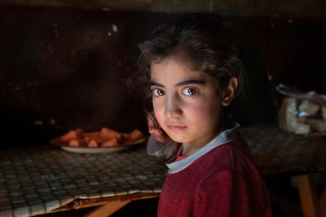
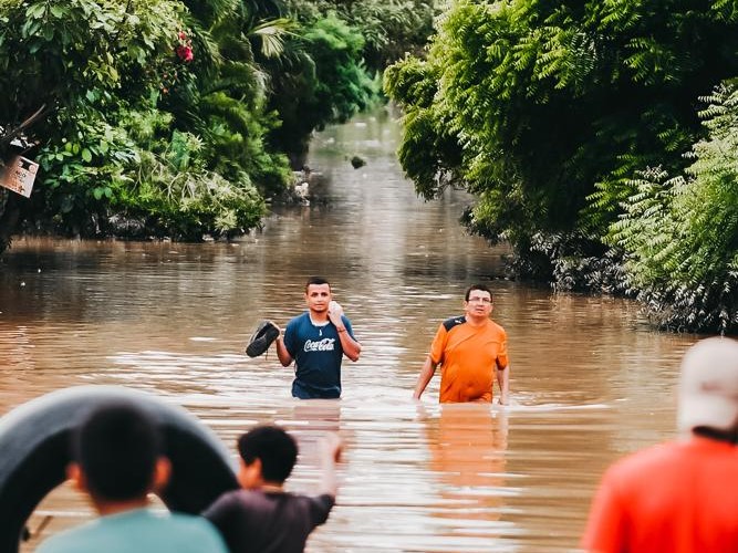
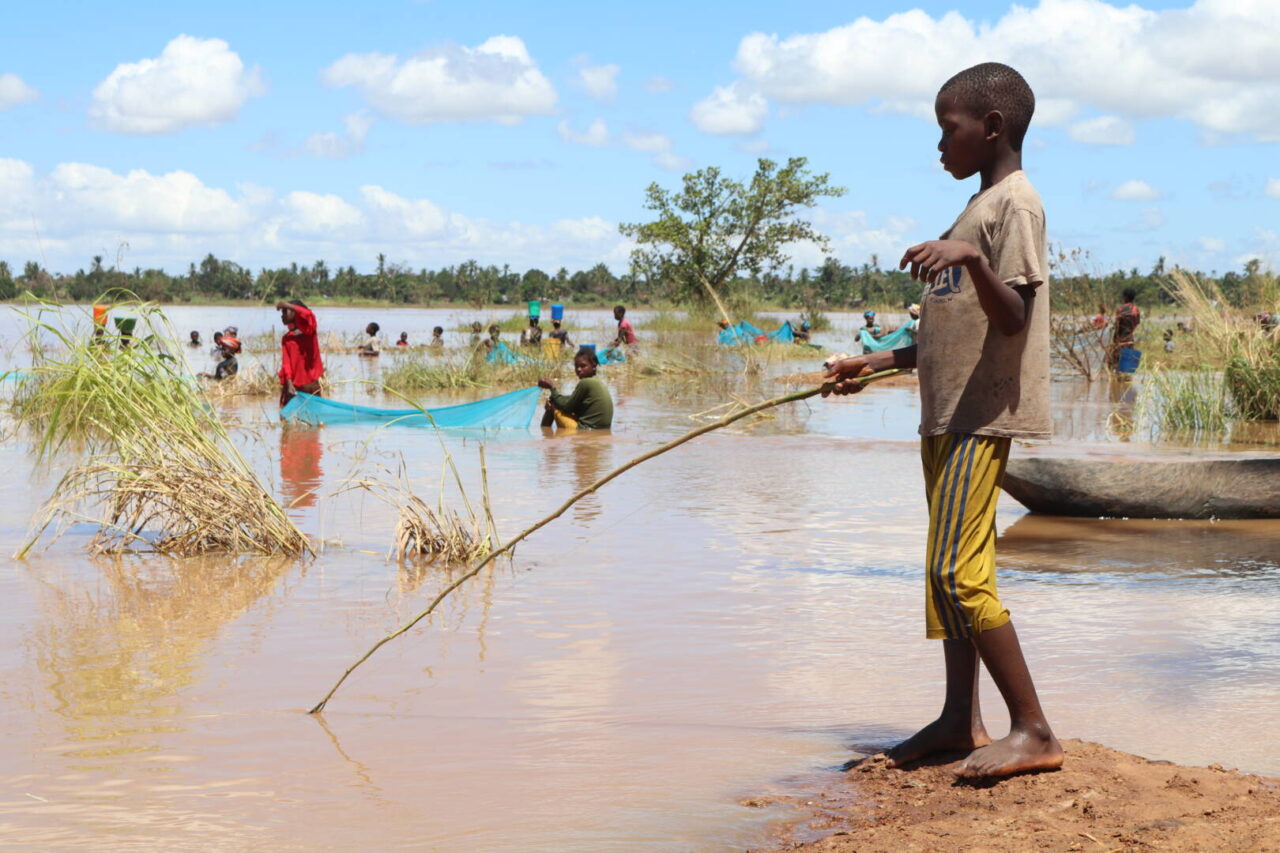
Coastal areas are vulnerable to storm surges, which can result in flooding and over-saturation of the ground, increasing the risk of landslides. Rural communities are often isolated when landslides destroy roads and disrupt power infrastructure. The destruction can leave children and people who depend on medical treatment or supplies especially vulnerable. Even after a hurricane passes, damaged materials need to be removed from flooded homes, as lingering moisture can foster the growth of dangerous mold.
How do I prepare for a hurricane?
If a hurricane is forecast for your area, it’s important to take the following steps to ensure your safety and preparedness:
- Stay informed: Sign up for emergency notifications. Follow official local news sources for the latest weather updates and evacuation orders.
- Prepare an evacuation plan: Check evacuation routes and emergency shelter information, fill up on gas, choose and inform an out-of-state contact person, establish a meeting place for your loved ones if you get separated, and pack a “go bag” with essential items you’ll need if you have to evacuate.
- Pack emergency supplies: Prepare an emergency supply kit that includes non-perishable food, drinking water, a flashlight, extra clothes, necessary medicine, protective gear, a battery-powered radio, hygiene items, critical documents, sentimental items, and any necessities for your pets.
- Secure your home: Take measures to protect your property from high winds and potential flooding. Install storm shutters or board up windows, elevate furnaces, and secure or remove items that could become projectiles in strong winds.
- Stay or go: If authorities issue an evacuation order for your area, follow it promptly. If you are not in an evacuation zone, consider moving to higher ground, stay indoors, and keep track of weather updates and other advisories.
- Learn more: For additional information and resources, visit ready.gov.
What’s the difference between a tropical depression, tropical storm, hurricane, and a major hurricane?
The distinction between a tropical depression, tropical storm, hurricane, and a major hurricane is the wind speed:
- Tropical depression: Wind speed less than 39 mph
- Tropical storm: Wind speed between 39 mph and 73 mph
- Hurricane: Wind speed between 74 mph and 110 mph
- Major hurricane: Wind speed greater than 110 mph
What are hurricane categories, and what do they mean?
A hurricane category, determined by the Saffir–Simpson hurricane wind scale, lets people know how powerful the hurricane will be:
- Category 1: Very dangerous winds between 74 and 95 mph will cause some damage, and power outages for a few days are likely.
- Category 2: Extremely dangerous winds between 96 and 110 mph will cause extensive damage, and a near-total power loss that could last up to a few weeks is expected.
- Category 3: Devastating damage from winds between 111 and 129 mph will occur. Electricity and water will be unavailable for several weeks, and trees will be snapped or uprooted, blocking roads.
- Category 4: Catastrophic damage will occur from winds between 130 and 156 mph. Even well-built framed homes will lose most of the roof structure and/or some exterior walls. Fallen trees and power poles will likely isolate residential areas, and power outages could last possibly months.
- Category 5: Catastrophic damage will occur from winds 157 mph or higher. A high percentage of homes will be destroyed, and most areas will be uninhabitable for weeks or months.
How do tropical storms and hurricanes get their names?
Meteorologists name tropical storms and hurricanes to avoid confusion and streamline communication. Before the 1950s, storms were identified in chronological order during a given year, but this occasionally led to miscommunication when multiple storms were happening. Since 1953, the World Meteorological Organization (WMO) has named tropical storms and hurricanes using a strict system: a 21-letter list of names, alternating between male and female names, on a six-year rotation. The list excludes the letters Q, U, X, Y, and Z. Every seventh year, the names recycle, unless the WMO decides to retire a name because it was particularly deadly or costly. Here’s the list of tropical cyclone names for the next six years.
What have been some of the worst hurricanes to strike the U.S.?
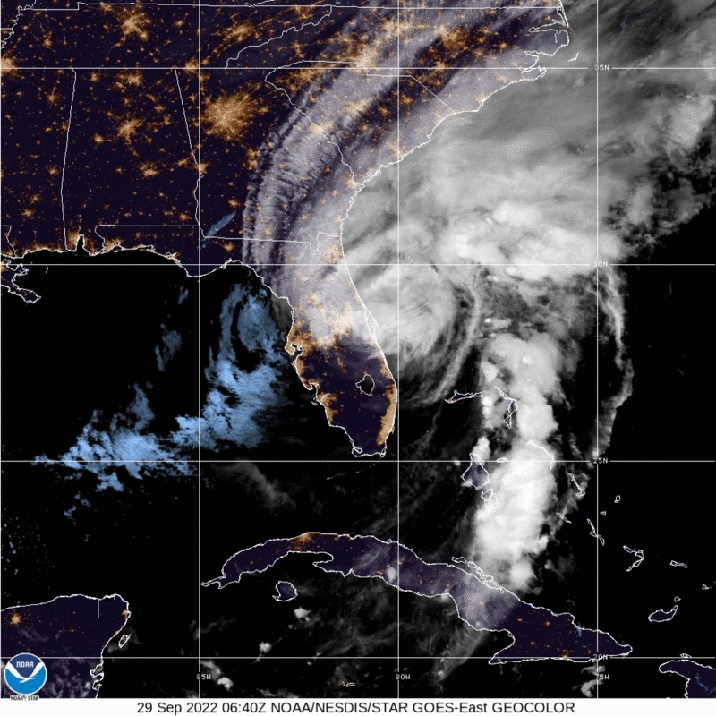
The 2022 Atlantic hurricane season stands out as especially deadly and destructive in recent years. Hurricane Ian made landfall along the southwestern Florida coast on September 28, 2022, bringing catastrophic damage with its high winds, heavy rainfall, and storm surges.
Here are some of the most notable hurricanes that have hit the U.S.:
- The Great Labor Day Hurricane (1935): This Category 5 hurricane was the most intense hurricane on record to make landfall in the United States. It struck the Florida Keys with devastating winds and a massive storm surge.
- Hurricane Camille (1969): Camille made landfall as a Category 5 hurricane in Mississippi, causing widespread infrastructure damage and loss of crops due to high winds and water.
- Hurricane Andrew (1992): Andrew struck South Florida as a Category 5 hurricane, with winds reaching 165 mph, before hitting central Louisiana as a Category 3 hurricane.
- Hurricane Katrina (2005): Katrina was the costliest hurricane in U.S. history ($192.5 billion*). Katrina caused catastrophic flooding in the Gulf Coast, particularly in Louisiana and Mississippi.
- Hurricane Harvey (2017): Harvey made landfall in Texas, bringing unprecedented rainfall and causing severe flooding in Houston and the surrounding areas. It ranks among the costliest hurricanes ($152.5 billion*) due to the extensive property damage.
- Hurricane Ian (2022): Ian raked a path of destruction across the southeast U.S., devastating the Gulf Coast of Florida before making final landfall in South Carolina two days later ($114 billion*).
*Costs have been adjusted for inflation.
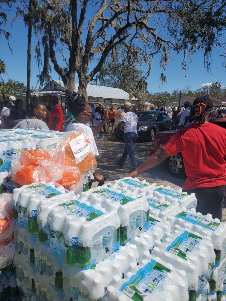
How does World Vision respond to hurricanes?
With decades of experience and an established global network of trained emergency staff, World Vision is responding to multiple major emergencies at any given time. That includes earthquakes, conflicts and refugee crises, floods, and hurricanes.
In 2022, World Vision responded to 59 humanitarian emergencies in 52 countries, assisting over 27.7 million people with life-saving aid and ongoing support.
During and after a crisis, we provide food, water, hygiene, and other basic relief items, including clean-up supplies. We also promote personal hygiene practices to guard against deadly disease outbreaks. Our child protection programs respond to urgent cases, such as children separated from their families, abuse, exploitation, and other forms of violence. We also respond to health, nutrition, and education needs.
Our goal is to support families in the immediate aftermath of a disaster and throughout the challenging process of rebuilding their lives and livelihoods. World Vision works alongside communities to help families rebuild their homes and establish permanent housing, sustainable access to clean water, food security, and access to quality education.
How can I help people affected by hurricanes and other natural disasters?
- Pray: Join us in praying for all those impacted by hurricanes and disasters around the world.
Almighty Father, we ask for Your mercy on people affected by devastating hurricanes and other disasters. In the midst of their struggle to recover, give them patience, peace, and hope that life will get better soon. We ask for wisdom and guidance for those involved in relief efforts and authorities responsible for disaster response.
- Give: Your gift will help provide relief to people affected by disasters like hurricanes.
Sevil Omer of World Vision U.S. contributed to this article.